Egremont, MA
$3,690,000
Berkshire County, Massachusetts
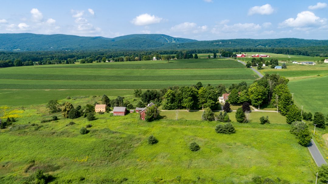
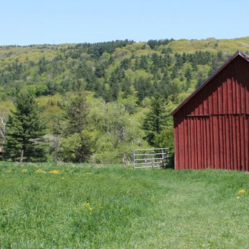
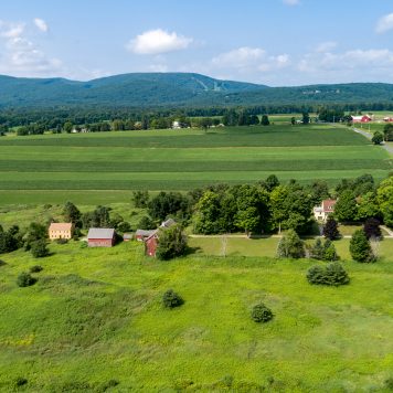
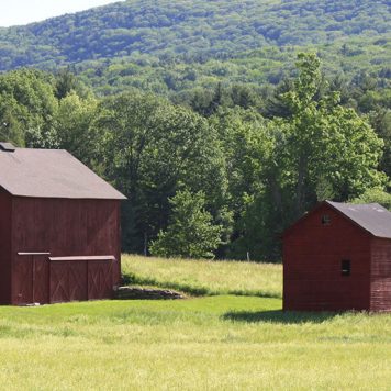
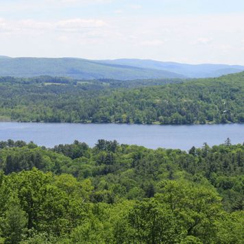
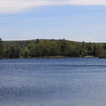
The bucolic town of Egrement, which lies along the western border of Berkshire County, consists of two villages, North Egremont and South Egremont. First settled in 1772 by Dutch settlers, the town was officially incorporated in 1761. Primarily an agricultural town throughout its history, Egremont comprises 18.9 square miles of area and boasts a population of about 1,372. The community has its own library, located in South Egremont, as well as post office and police, fire and public works departments. Students in Egremont, along with five other towns, are served by the Southern Berkshire Regional School District, and numerous private schools are also located in Great Barrington and Salisbury, Connecticut, among other local communities. Geographically, the town is bordered to the north by Alford, to the east by Great Barrington, to the southeast by Sheffield, to the southwest by Mount Washington, and to the west by Copake and Hillsdale, New York. A valley town rich in natural resources and unspoiled scenic beauty, Egremont is situated east of the Taconic Range, and it is divided by several mountains, including Mount Whitbeck. The town lies along the Green River, a tributary of the Housatonic River. The nearest interstate is the Massachusetts Turnpike (I-90), which is located north of town, the closest bus or rail service is found in Great Barrington, and the nearest regional/international air service is provided by Bradley International Airport out of Windsor Locks, Connecticut.
The bucolic town of Egrement, which lies along the western border of Berkshire County, consists of two villages, North Egremont and South Egremont. First settled in 1772 by Dutch settlers, the town was officially incorporated in 1761. Primarily an agricultural town throughout its history, Egremont comprises 18.9 square miles of area and boasts a population of about 1,372. The community has its own library, located in South Egremont, as well as post office and police, fire and public works departments. Students in Egremont, along with five other towns, are served by the Southern Berkshire Regional School District, and numerous private schools are also located in Great Barrington and Salisbury, Connecticut, among other local communities. Geographically, the town is bordered to the north by Alford, to the east by Great Barrington, to the southeast by Sheffield, to the southwest by Mount Washington, and to the west by Copake and Hillsdale, New York. A valley town rich in natural resources and unspoiled scenic beauty, Egremont is situated east of the Taconic Range, and it is divided by several mountains, including Mount Whitbeck. The town lies along the Green River, a tributary of the Housatonic River. The nearest interstate is the Massachusetts Turnpike (I-90), which is located north of town, the closest bus or rail service is found in Great Barrington, and the nearest regional/international air service is provided by Bradley International Airport out of Windsor Locks, Connecticut.
The bucolic town of Egrement, which lies along the western border of Berkshire County, consists of two villages, North Egremont and South Egremont. First settled in 1772 by Dutch settlers, the town was officially incorporated in 1761. Primarily an agricultural town throughout its history, Egremont comprises 18.9 square miles of area and boasts a population of about 1,372. The community has its own library, located in South Egremont, as well as post office and police, fire and public works departments. Students in Egremont, along with five other towns, are served by the Southern Berkshire Regional School District, and numerous private schools are also located in Great Barrington and Salisbury, Connecticut, among other local communities. Geographically, the town is bordered to the north by Alford, to the east by Great Barrington, to the southeast by Sheffield, to the southwest by Mount Washington, and to the west by Copake and Hillsdale, New York. A valley town rich in natural resources and unspoiled scenic beauty, Egremont is situated east of the Taconic Range, and it is divided by several mountains, including Mount Whitbeck. The town lies along the Green River, a tributary of the Housatonic River. The nearest interstate is the Massachusetts Turnpike (I-90), which is located north of town, the closest bus or rail service is found in Great Barrington, and the nearest regional/international air service is provided by Bradley International Airport out of Windsor Locks, Connecticut.
Egremont
Egremont is within The Berkshires, Massachusetts and borders Alford, Great Barrington and Sheffield.
Loading...


Looking for a home in Egremont? We can help. Contact us below!
Yes, I would like more information from Sotheby's International Realty. Please use and/or share my information with a Sotheby's International Realty agent to contact me about my real estate needs.
By clicking Send Message, I agree a Sotheby's International Realty Agent may contact me by phone or text message including by automated means about real estate services, and that I can access real estate services without providing my phone number. I acknowledge that I have read and agree to the Terms of Use and Privacy Policy